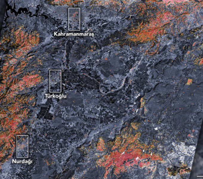

The magnitude 7.8 and 7.5 earthquakes that struck southern Türkiye and western Syria on February 6, 2023, caused widespread destruction in both countries.
The initial earthquake emanated from a fault 18 kilometers (11 miles) below the land surface. The shallow depth meant the earthquake produced violent shaking that affected areas hundreds of kilometers from the epicenter. The first quake was followed by a 7.5 magnitude event about nine hours later, as well as hundreds of smaller aftershocks.
As news of the event spread, scientists at space agencies around the world—including NASA—began processing and analyzing satellite data relevant to the event.
Members of the disasters program area of NASA’s Earth Science Applied Sciences, as well as their national and international collaborators, are in the process of sharing the damage proxy map and the data used to generate it with organizations such as the U.S. State Department, the California Seismic Safety Commission, Miyamoto Global Disaster Relief, and the World Bank. The team is also participating in ongoing coordination calls hosted by the U.S. Agency for International Development to assess the needs of stakeholders in the region and provide scientific expertise to support risk assessment and recovery efforts.
Original Story by Adam Voiland. NASA Earth Observatory images by Joshua Stevens, using Landsat data from the U.S. Geological Survey and ALOS-2 data from the Japan Aerospace Exploration Agency/JAXAand the Earth Observatory of Singapore Remote Sensing Lab.